Products
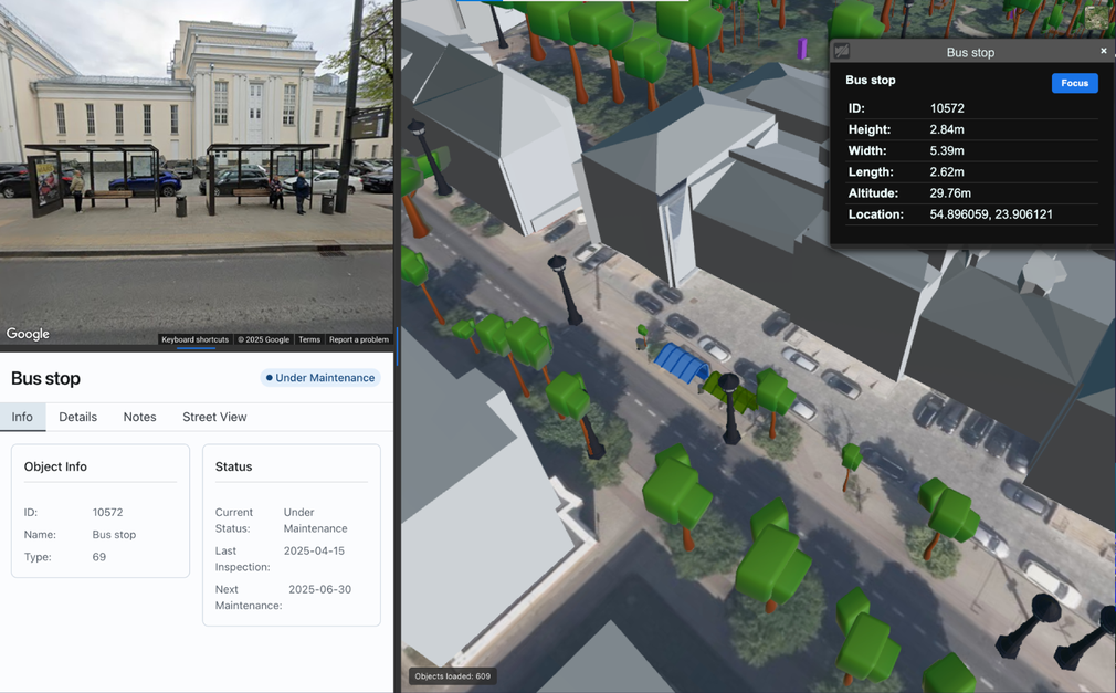
Smart City Digital Twin Platform

Living 3D Digital Twin for real-time road & infrastructure monitoring with AI-powered change detection and spatial insights.
Matom.AI delivers living 3D City Digital Twins for real-time monitoring of roads and urban infrastructure. By fusing LiDAR, photogrammetry, and IoT data, the platform creates a continuously updated spatial model powered by AI change detection and automated asset segmentation. Authorities can track asset condition, detect infrastructure changes, map road elements, and enhance safety through data-driven insights.
Read more
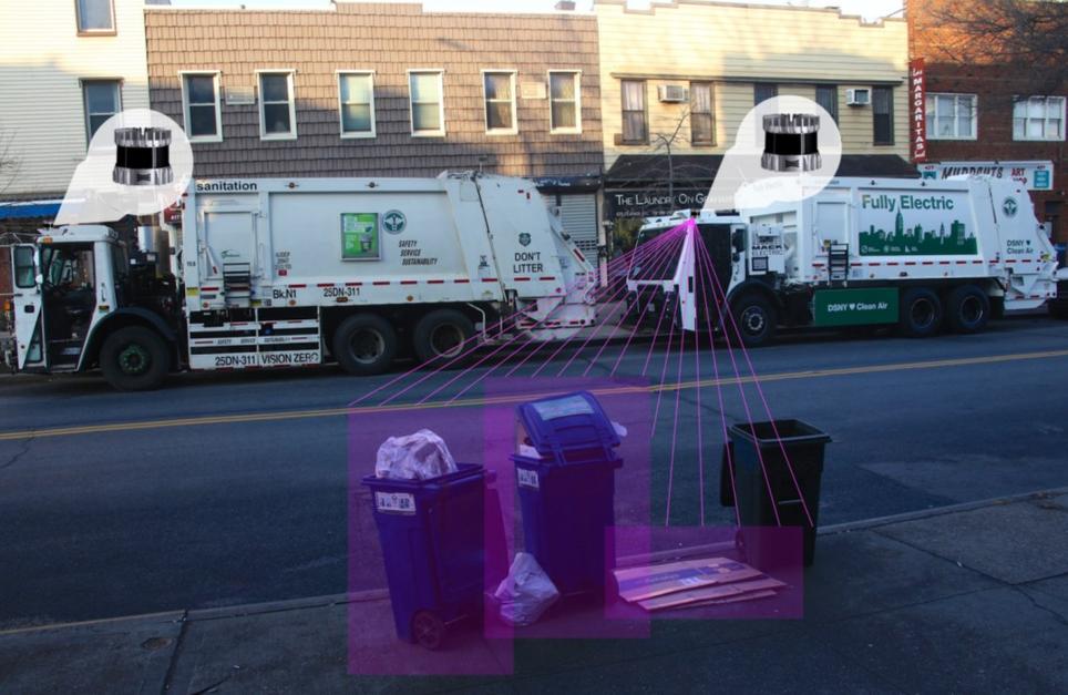
AI Road Infrastructure Extraction
Automatic extraction of road assets from LiDAR and aerial data — signs, poles, guardrails, markings and other infrastructure layers.
Matom.AI automatically extracts road infrastructure assets from LiDAR and aerial datasets. Our system classifies objects such as traffic signs, poles, guardrails, lane markings, lighting, and roadside structures directly from point clouds or photogrammetry models. The output is delivered as structured GIS layers ready for asset management systems. This eliminates manual GIS digitization and significantly reduces the time required to build and maintain road infrastructure inventories.
Read more
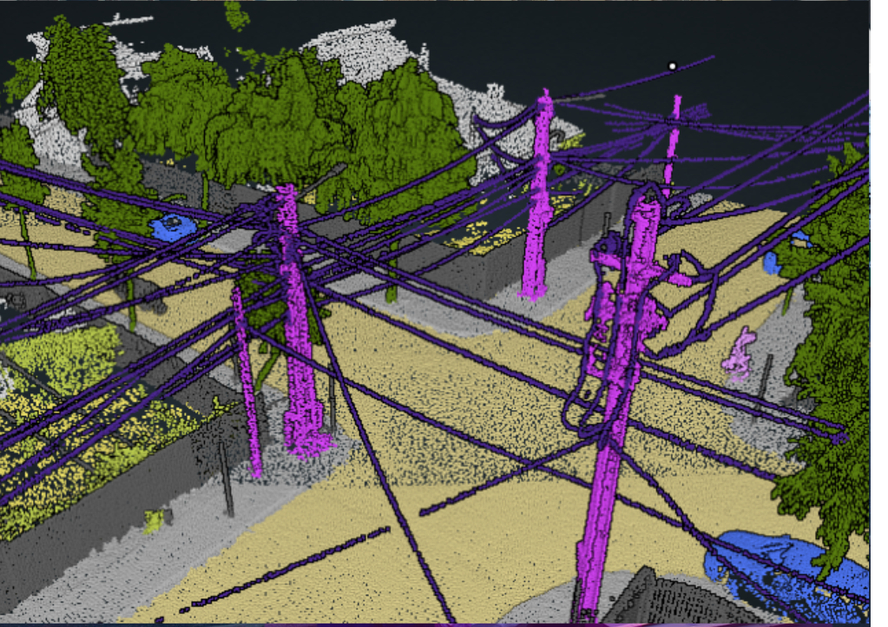
Infrastructure Change Detection
Detect changes in road infrastructure between scans — missing signs, shifted barriers, vegetation encroachment or new objects.
Matom.AI compares infrastructure datasets collected over time and automatically detects physical changes. The system identifies missing or newly installed traffic signs, shifted guardrails, vegetation encroachment, damaged assets, or construction changes. Instead of manually reviewing large spatial datasets, road authorities receive change alerts highlighting only the affected areas. This enables faster infrastructure audits and helps maintain up-to-date asset registers.
Read more
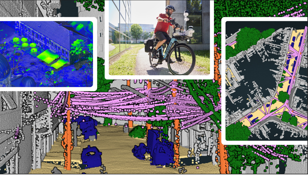
Spatial Data Processing for Mobility Infrastructure
Processing LiDAR and aerial datasets into structured infrastructure intelligence for roads, railways, ports and urban mobility networks.
Matom.AI provides automated processing pipelines for large-scale spatial datasets used in infrastructure projects. We convert LiDAR point clouds and photogrammetry models into structured information layers including infrastructure objects, terrain, and asset classifications. The system supports mobility infrastructure environments such as roads, railways, ports and airports. Outputs integrate with GIS and engineering systems, enabling organizations to transform raw scan data into actionable infr
Read more
AI Infrastructure Intelligence from LiDAR Data
Automated extraction of road infrastructure and change detection from LiDAR and aerial datasets for faster asset audits and infrastructure monitoring.
Matom.AI develops AI systems that convert LiDAR and aerial datasets into structured infrastructure intelligence. Our platform automatically extracts road assets such as signs, poles, guardrails, lighting and other roadside elements from point clouds and photogrammetry models. The system also detects infrastructure changes between scans, helping authorities identify missing assets, damage or new objects. Outputs integrate with GIS and asset management systems, reducing manual spatial data process
Read more