Spatial Data Processing for Mobility Infrastructure
Processing LiDAR and aerial datasets into structured infrastructure intelligence for roads, railways, ports and urban mobility networks.
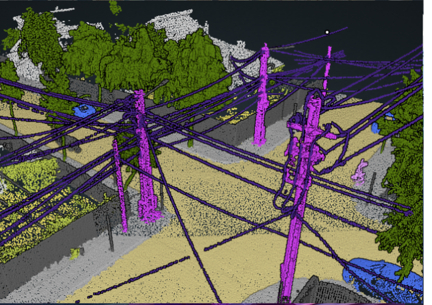
Matom.AI provides automated processing pipelines for large-scale spatial datasets used in infrastructure projects. We convert LiDAR point clouds and photogrammetry models into structured information layers including infrastructure objects, terrain, and asset classifications. The system supports mobility infrastructure environments such as roads, railways, ports and airports. Outputs integrate with GIS and engineering systems, enabling organizations to transform raw scan data into actionable infr