Smart Asset Management: Managing Expectations
There are numerous quotes apportioned to equally numerous experts that explain the fundamental differences between monitoring, measuring and managing. They’re all succinct and pithy in their own way but when it comes to the smart management of transport-based assets (such as a network of roads), or even the management of smart transport-based assets, the picture is significantly wider and not so easy to explain in a handy, bite-sized slogan.
However, one such appropriate quote is: “If you can’t measure it, you can’t manage it – and if you are only measuring it, you are still not managing it.” That, it has to be said, certainly applies to smart asset management.
With that in mind Intertraffic spoke with three highly knowledgeable people involved in three different aspects of smart asset management, namely digital twinning, the role of artificial intelligence and the sector’s place within the framework of the Internet of Things to ascertain the direction in which this fascinating sector is heading.
IRF Champions Predictive Asset Management with Artificial Intelligence
“Artificial intelligence and big data carry the promise of a more centralised, regulated, objective and cost-effective approach to traditional asset maintenance management processes,” says Brendan Halleman, the International Road Federation’s Vice President, Europe and Central Asia.
“Data collection methods are the backbone to effectively understand the condition of an asset (such as a road network). Annual data collection using laser trucks gather highly accurate condition information such as roughness and rutting is common practice within maintenance management,” he continues. However, these are often associated with high costs and lack the ability to determine cause and effect.
“Large data sets also require an impractical exchange of data that are reliant on manual handling, formatting and manipulation to maintain consistency and find common trends,” says Halleman. “Similarly, ad hoc data collection is the method of collecting information on a case-by-case basis, while these are commonly smaller data sets, observing similar trends such as inconsistency, variability and lack of regulation can be found in both methods.”
With the rapid increase of computer power and the low cost of data storage, AI is increasingly being deployed in various fields to more effectively and accurately manage, model and predict data within time frames that would otherwise be very expensive, extremely time consuming and subjective decision for humans to carry out. Moreover, he suggests, research has shown the potential of AI to utilise and link big data repositories together in such a way that predictions can be made on current up to date insight of asset condition data.
"In the field of road asset management, algorithms are already being trained using machine learning techniques on existing data sets such as road conditional data (captured from laser profilometers), crash history, pavement strength and historical maintenance and trends. This will provide the “fingerprint” of a section in estimating the future condition and likelihood of failure criteria and maintenance that is required.”
With the latest AI and computational advancements, it is possible to automatically identify functional distresses such as potholes, cracks, edge breaks, by employing deep learning techniques from visual data such as photos and videos.
Explains Halleman: “The data collection of videos and photos can be done at a traffic speed. The combination of existing data and functional distress can be taken into account and apply machine learning techniques to understand the fingerprint of a road condition historically and the maintenance actions were recorded that that time. This approach will help achieve the short-term planning. Existing condition data with the prediction of future functional distress can influence long-term maintenance strategies. We can use deep learning algorithms that take large amounts of data to find common trends among data sets, predict future conditions, and derive preventive measures from the predictions to more effectively maintain safe and reliable roads.
“The practical reality of using AI in the field of smart management is still emerging, including how to regulate, assimilate and centralise data in such a way that asset maintenance and management uses the benefits of AI alongside existing expert knowledge and data repositories to improve algorithms which in turn will yield a more holistic visualization of current road network conditions as well as a deeper understanding of future network performance.”
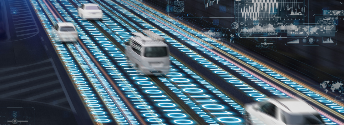
IoT road surface sensing
For Tom van der Ven of the Netherlands’ Mobility Sensing, advances in AI have changed the game for the smart asset management players.
“Autonomous sensing pods can significantly drive down costs of road and traffic data,” he says. “Several technology trends have led to the development of ultra low-power, autonomous, wireless sensor pods. The pods can be installed and swapped in minutes and require no external data or power connection. Once installed they provide a continuous stream of live data on the state and use of transport networks.”
What technological developments have caused this new sensing market to emerge?
“New data communication networks have been deployed that put the development of the Internet of Things (IoT) in overdrive. These networks allow millions of devices to send small amounts of data using very low power transmitters. AI has become mainstream,” he surmises. “Tool kits make AI readily available to software developers and the continuing decrease in the costs of computing power means that AI can be deployed not only in the cloud, but also in compact devices (pods).”
Advances in power harvesting technology, in particular solar power, allow pods to harvest sufficient ambient energy to keep their power stores charged. As the efficiency of power harvesting increases further, batteries can be replaced by the more environmentally friendlier capacitors.
"These technologies have led to the emergence of new IoT sensing solutions in traffic and transport. These solutions rely on autonomous self-powered sensor pods that continuously collect sensor data, interpret the data using advanced algorithms, and report relevant information wirelessly to the Cloud"
“When combined these technologies have led to the emergence of new IoT sensing solutions in traffic and transport. These solutions rely on autonomous self-powered sensor pods that continuously collect sensor data, interpret the data using advanced algorithms, and report relevant information wirelessly to the Cloud.”
As the market for IoT sensing solutions matures, pod production costs will decrease further, says van der Ven, while installation and maintenance costs remain about the same.
“This in turn will lead to the development of multipurpose sensor pods, i.e. pods designed to take a particular part of a transport network online, rather than having a single purpose such as traffic counting. As these trends converge every part of transport networks can be taken online, bringing the transport infrastructure into the Internet of Things.”
An example of such an innovative IoT sensing solution is Mobility Sensing’s StreetSense. Twenty StreetSense pods can be installed in a single day, providing road operators with instant valuable insights in the state and use of their road network.
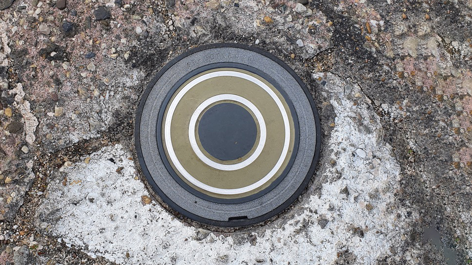
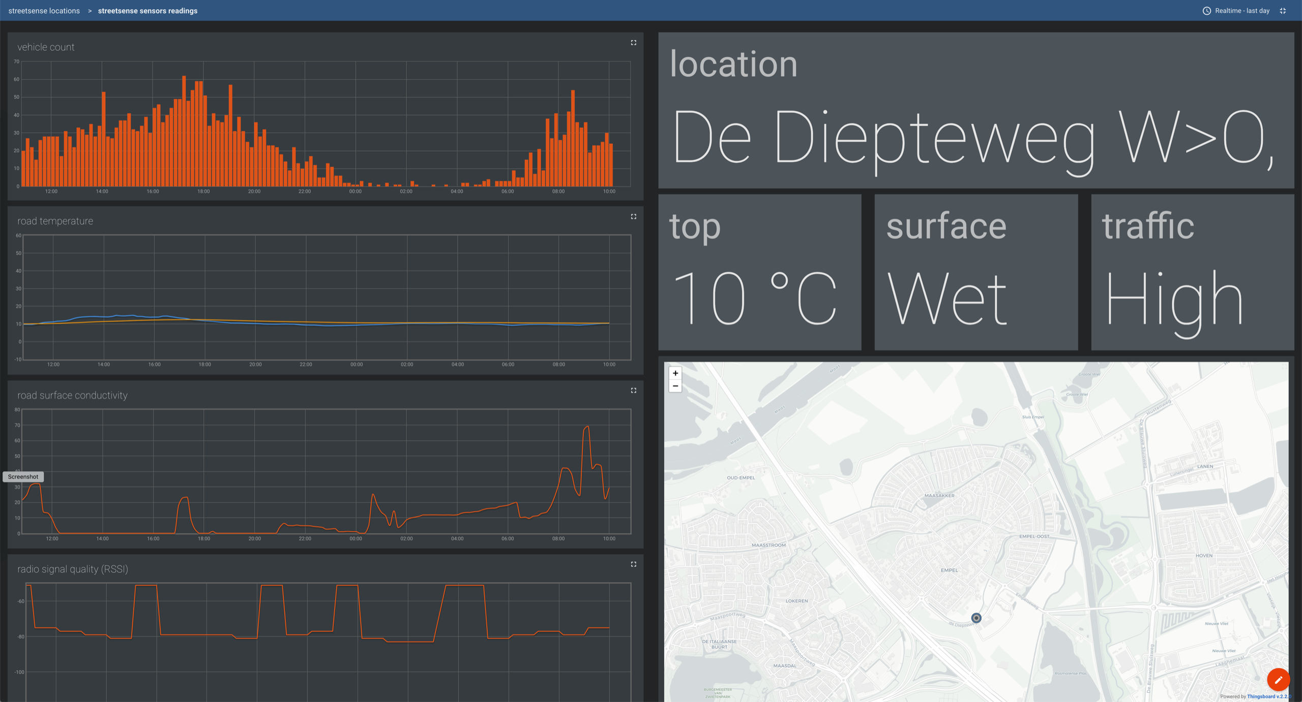
“Every 10 minutes StreetSense measures the in-situ temperature of the road surface and the road deck, as well as the road deck condition (dry, moist, wet) and the amount of road salt on the road surface. It continuously counts passing traffic and every hour it sends all collected information to the StreetSense Cloud,” van der Ven explains.
“Each StreetSense pod can warn the road operator, e.g. to cool or grit the road deck to prevent heat stress or prevent black ice from forming. It can also warn traffic managers for high traffic loads. Every StreetSense pod can even warn road users for skid hazards and stationary traffic in this one particular street. The live and historic data are conveniently presented in a secure web dashboard in lists, charts and maps for road operators.”
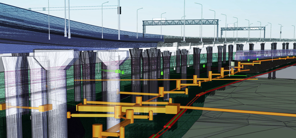
Digital Twins to improve understanding
Our world is transforming and rapidly becoming digital. This digital transformation as it relates to transportation needs to help support the new challenges in mobility, safety, and environment, as well as better maintenance of existing assets. To help align digital strategies to these challenges, this is increasingly involving the creation of a digital twin.
Marcel de Rink, Customer Success Manager for Esri Nederland, explains what a digital twin and how the concept is transforming the way in which transport assets are managed.
“A digital twin is a virtual representation of the real world, including physical objects, processes, relationships, and behaviors. GIS creates digital twins of the natural and built environments and uniquely integrates many types of digital models. Geospatial technology connects different types of data and systems to create a single view that can be seamlessly carried and accessed throughout the complete project life cycle. GIS enhances data capture and integration, enables better real-time visualization, provides advanced analysis and automation of future predictions, and allows for information sharing and collaboration.”
In terms of what this means for highway agencies across the world, de Rink explains that a digital twin of the highway network becomes the foundation for the better management of the transportation system.
“A highways agency uses a variety of sensors in the roads to help monitor traffic, which when combined with other real-time data such as floating car data, can give highway operations staff a comprehensive view of the network in real time. We can then add crash data, which in our digital twin gives us a realistic, 3D view of the crash location and surroundings. Increasingly both drones and CCTV cameras can help first responders better understand the context to help guide their response.
“The same digital twin helps us better understand not only mobility,” he adds, “but the factors influencing mobility demand. We can understand the surrounding land uses, whether industry, recreation, or agriculture, and how they impact road usage, but also the impacts from the roadway such as sound pollution, emissions, and other environmental and wildlife impacts.”
Digital twins also helps us better understand roadway assets and, crucially, monitor the condition of those assets.
“Increasingly road agencies are using 3D imagary and LiDAR capture of their roadways to develop comprehensive asset registries, through feature extraction in GIS technology. Increasingly artificial intelligence, machine learning and drones are used to continuously update the status of all of those assets, including assets such as sign and pavement markings that will be critical for autonomous navigation. In turn, GIS technology associates those images to the proper asset, all part of the larger digital twin.”
"Increasingly artificial intelligence, machine learning and drones are used to continuously update the status of all of those assets, including assets such as sign and pavement markings that will be critical for autonomous navigation"
The real power of the digital twin lies in its ability to support complex modelling, as well large data analysis to discover new patterns and make better predictions. GIS helps to manage not only the different spatial aggregation levels (1D, 2D and 3D), but also allows us to combine data from many different sources into a single view, and to apply latest spatial data analysis capabilities, such as clustering, to help us better understand, and predict outcomes related to our transportation systems. This is the real power of GIS and spatial thinking, as de Rink explains.
“Highway Administrations interact with a much larger number of other actors, whether their contractors, other public agencies and public safety agencies, and GIS (and the Digital Twin) allows them all to share, collaborate, visualize and analyze information together to achieve better outcomes. This type of collaboration cannot only increase mobility but lead to safer and more equitable transportation systems.”
Digital twins have allowed us to better understand the complex relationships in our transportation systems and to design more sustainable policies and investments.
“By modelling and visualizing different alternatives against the digital twin, we can help design the sustainable cities of the future and create more efficient and equitable transportation systems for the next century,” de Rink concludes.
Share your story
Do you have an innovation, research results or an other interesting topic you would like to share with the professionals in the infrastructure, traffic management, safety, smart mobility and parking industry? The Intertraffic website and social media channels are a great platform to showcase your stories!
Please contact our Sr Brand Marketing Manager Carola Jansen-Young.
Are you an Intertraffic exhibitor?
Make sure you add your latest press releases to your Company Profile in the Exhibitor Portal for free exposure.
.png?h=400&iar=0&w=1400)
.png?h=628&iar=0&w=1200)
.png?h=400&iar=0&w=1400)
Get up to speed on the mobility industry - our newsletter straight to your inbox!