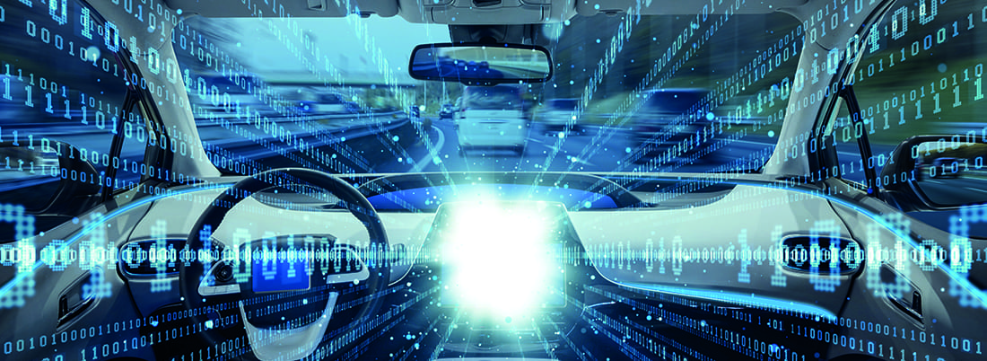
Managing traffic with smartphone data

Is it possible to build a complete picture of traffic in a city or on a freeway, using only ‘floating car data’ collected from driver and passenger smart devices? And if so, what does this mean for traditional roadside sensors?
Throughout the developed world, road agencies acquire the data used to manage traffic on their roads from roadside sensors such as induction loops, radar or cameras – a monitoring infrastructure that is costly and requires ongoing maintenance. Increasingly, they are supplementing data from these sensors or even seeking to replace them altogether with floating car data generated by mobile devices moving on their network. But how reliable is this data, how is it evolving, and what possibilities might it open up in the future?
 “It can be any data, but originally it was just GPS points, which is still big business at the moment,” explains Dr Ben Rutten, Strategic Area Smart Mobility (SASM) project manager at the University of Eindhoven in the Netherlands. “For monitoring the length of traffic jams and especially the delay time, floating car data is the best way to get information from the traffic system. You’re letting the car produce the data itself.” Increasingly, data is aggregated via traffic or navigation apps, either on phones or in cars. “GPS points are collected in the cloud and, using data techniques, traffic information for a road section extracted. This is made available both to the drivers using the service and to traffic managers.”
Unlike induction loops, which capture the entire vehicle population, floating data tends to involve only a relatively small percentage, depending on the data provider. When fewer cars are on the road, the sample becomes smaller and less reliable, meaning data does have the virtue of being more reliable on busy roads – where the need for traffic management is most pressing. “You will never measure 100% of cars,” says Rutten. “But at between 2% and 5% you can really make accurate calculations and give good travel time estimations.” A recent TNO study concluded that Dutch authorities could replace 20% of induction loops with floating data from Google with only a 3% degradation in data quality – begging the question, could roadside sensors one day be rendered obsolete by cloud-based data?
The big match
Floating car data is useful for traffic management during special events, such as football matches. But what are the limits?
Rijkswaterstaat (RWS), the agency responsible for public roads in the Netherlands, is using floating data to gain enhanced insights into network traffic flows. “Our highways have induction loops, which are old-fashioned, very good, but expensive,” says Ron Phaff, RWS traffic manager for the city of Eindhoven. “For now, we are measuring traffic jams using floating data and comparing results with traditional loops, so we can stop building new loops.”
 With PSV Eindhoven preparing to play host to Barcelona in the Champions League, floating data will transform the way Phaff’s team handles the traffic influx caused by major events. “Smaller city streets don’t have loops,” he says, “so before, we would send traffic into the city, but didn’t know what happened after that. But floating data is everywhere, so every road gives information, so we can get traffic to its destination. Traffic doesn’t stop at the end of the highway, but goes onto the roads of other authorities.”
He believes floating data is accurate enough for providing traffic information, but not yet ready for safety-related applications like informing VMS. “It’s rapidly improving, but traditional loops always work, every day. But what does floating data do at night, with less traffic? When people go to school by bicycle – is that people cycling, or slow traffic? There’s also a political issue: do we completely depend on other providers or use traditional loops of our own? But floating data is helping us to learn about incidents and to improve through our plan-do-check-act cycle.”
RWS is also experimenting with parallel forms of data collection. “We have a test road with our own wi-fi network,” says Phaff, “but making a ‘handshake’ at 60mph [100km/h] is a difficult challenge.
“When you walk into a building, your telephone makes contact with the wi-fi network. If you have wi-fi points near the road and you’re driving at 60mph, every time you switch to the next access point, you have to make that handshake: we have to solve that technical situation.”
“There’s debate about whether we’ll need this fixed infrastructure if probe data becomes available in large quantities, but I don’t think we’ll totally eradicate traditional sensors,” says traffic consultant Bob McQueen. “One challenge with probe data is: How do you figure out what percentage of the total vehicles you’re getting?” This is pertinent to US state DOTs, required to provide federal government with the total number of vehicles using their roadway system. “Secondly, there is orthogonal sensing: a military term for getting data from different places and using the sum value to assess veracity.” Without physical sensors, ground-truth verification of floating data becomes difficult. “How effective is it in rural areas, with a smaller sample size?” he continues. “Then, in a hurricane, if cell phone coverage goes down, what’s your Plan B?”
Floating incident detection?
Opinions vary regarding floating data use for safety-critical applications such as incident detection. Some experts point out that, through apps like Waze, drivers are sometimes reporting incidents more quickly than they are detected by traditional means. Meanwhile, others fear accidents could go undetected if no clients of a given floating data provider are directly involved. But Rutten believes there is a growing case for replacing variable message signs (VMS) with communication via navigation apps. “Technically, it’s already possible to replace expensive VMS with in-car or smartphone systems, which everyone already owns. VMS is just at certain points, but navigation systems give network-wide coverage. Maybe only 20-40% of drivers have these systems, but it’s only a matter of time. Research shows that many drivers don’t see or don’t trust VMS, but they trust their own system.”
However, important obstacles to replacing VMS remain. “It’s about whether governments and road authorities are willing to rely on private companies,” says Rutten. “It’s also important that the road users currently get the information for free, because the governments are investing in roadside units, so the big question is: are users willing to buy a subscription? But in the Netherlands, it is now official policy not to build more roadside infrastructure, but to stimulate drivers to use in-car systems for information. Car manufacturers now have contracts with navigation suppliers and are integrating their apps in-dash. Collecting information is one piece, then there’s enhancing it in the cloud and distributing it, via subscription services, to different end users.”
As mobile devices and navigation apps become integrated into vehicles, the potential grows for road agencies to obtain not just location reports, but much richer data from onboard vehicle sensors. “Forbes magazine pointed out that the Ford Fusion hybrid has 147 sensors on board, generating 25GB of data per hour,” recalls Bob McQueen. “Multiplied across the entire US fleet, that comes to 2 exabytes of data per year – half the size of the entire internet. There could be a tidal wave of data from vehicles, a huge asset, but also a potential headache to deal with. We’re getting very excited about p-codes: cars have perhaps 300 of these, telling you things like engine condition, water temperature, and what the headlights or washers or brakes are doing. That’s super-probe data, giving you a much more detailed picture of prevailing conditions.”
“Cars are increasingly computers-on-wheels,” says Rutten. “The CANbus has a lot of information about whether it’s raining or when you are turning your steering wheel or braking.” One application could involve using vehicle reports of rapid changes in vertical acceleration to detect potholes for road maintenance purposes. But while extracting CANbus data to provide cloud-based services is possible, security is a major obstacle. “There are ways to have read-only access to the CANbus, but automotive OEMs are not happy to open it up,” says Rutten. “Pilots have proved it works, but the issue is turning it into a scaled system where you trust that the car cannot be hacked. But when you own a car, you can ask a third-party to extract CANbus data, so road managers are using their own monitoring cars to drive the whole road system every month or quarter and collect data.”
Maps and enforcement
But running your own fleet is far more expensive than obtaining data from floating systems, so navigation firms are exploring ways to gather camera-based data from cars. “Lane-keeping systems use cameras trained to detect lines on the road, which could also be used for detecting dangerous situations,” says Rutten. “It’s in its infancy, but mapping companies are working on collecting data from users with a camera-based smartphone on their dashboards to improve their high-definition maps – an expensive job if you use your own cars.”
As ever-richer data is collected, should drivers be concerned about privacy, or data being taken and used against them, for enforcement? “Anonymity is fairly straightforward,” says McQueen “You aggregate data and look for trends across the network, rather than individual driver behavior. But we face a challenge because, on one hand, customers are looking for customized travel experiences, but on the other hand, they don’t want you to know about them. All things have dual uses and I suspect we may be unable to avoid enforcement at some point. Here’s a scenario: what if my smart vehicle rats me out as the cause of the accident? You could see a guy at the roadside shooting the engine to get rid of the data!”
But Rutten is less equivocal: “As soon as Apple, Google or TomTom collect floating car data, they make it anonymous.” Although de-anonymized mobile data offers potential to calculate the travel time between two locations, and thus enforce penalties for average speed violation, he believes data providers would never allow this to happen. “It’s not in their interests; they are the friends, not the enemies of drivers, who only use their service when they’re happy with it.”
So, while data from mobile devices may partially replace some physical sensors, vendors of roadside enforcement technologies are unlikely to see their markets floating away any time soon.
Replacing sensors
A new study shows the degree to which it is possible to reduce sensor deployment, thanks to smart technologies
Floating car data from Google-enabled devices in vehicles could replace 20% of existing induction loop sensors across 18.5 miles (30km) of the A12 outside Amsterdam with only a 3% diminution in data quality, a 2016 study by Dutch applied scientific research organization TNO has concluded. This could potentially reduce costs by €364,000 (US$419,000), while not installing 20% of induction loops in a greenfield situation could save as much as €700,000 (US$805,000).
Google floating car data may offer a disruptive level of penetration, since Google can follow not only devices using its Android operating system, but also any non-Android phone running a Google app: in theory, the vast majority of mobile devices worldwide. Moreover, it recently signed a deal to provide the Android operating system and an ecosystem of Google apps embedded into Renault, Nissan and Mitsubishi vehicles from 2021.
 Google data forms the basis of ODIQ, a cloud-based traffic monitoring solution built on top of the Google Maps Platform by Belgian firm Localyse. “Presently, traffic modelers and managers need any data they can lay their hands on, but floating car data is potentially the most cost-effective,” says Localyse international business development manager Olav Adami. “Roadside infrastructure is costly and maintenance-intensive. Floating data may not completely replace roadside sensors, but could be highly complementary, with authorities finding a nice balance between investment in hardware and using this data.”
In developed countries such as the Netherlands, with densely ranked induction loops every 500m (1,600ft) on key highways, any transition to increased reliance on floating data may be a gradual process of retirement and non-replacement of a proportion of existing hardware. By contrast, floating data could have an immediate and transformative impact in poorer countries, opening up hitherto unimagined vistas of traffic information. “We’re talking to cities like Cairo, Lagos and Nairobi, which lack elaborate roadside infrastructure,” says Adami. “They can start using floating data to gain insight into traffic flows and how to manage them. It’s a real opportunity for them to get a low-cost, high-value source of data.”
Make sure you check back next month for more on the upcoming edition of Intertraffic World.
Source: Intertraffic World 2019, written by Jack Roper
Share your story
Do you have an innovation, research results or an other interesting topic you would like to share with the professionals in the infrastructure, traffic management, safety, smart mobility and parking industry? The Intertraffic website and social media channels are a great platform to showcase your stories!
Please contact our Sr Brand Marketing Manager Carola Jansen-Young.
Are you an Intertraffic exhibitor?
Make sure you add your latest press releases to your Company Profile in the Exhibitor Portal for free exposure.
.png?h=183&iar=0&w=290)
Get up to speed on the mobility industry - our newsletter straight to your inbox!