Products
MapEye
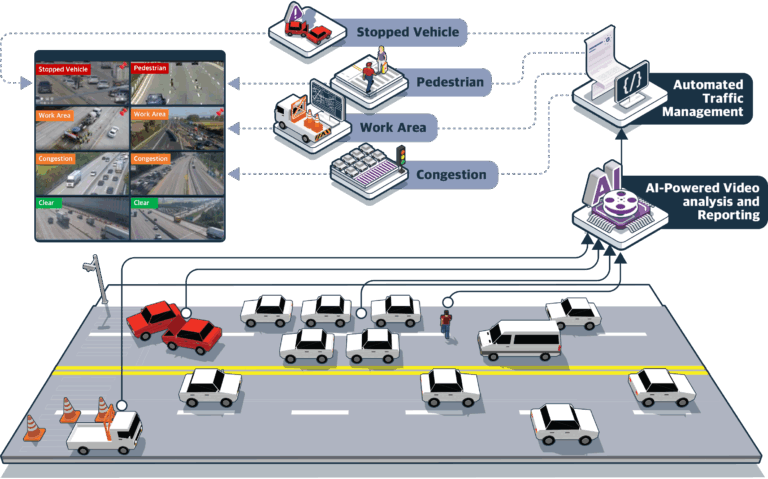
Automated incident detection system leveraging AI
A modular Automated Incident Detection System that transforms traffic operations through real-time CCTV analysis. The platform instantly detects hazards, performs AI-driven risk assessment, and uses Vision-Language Models (VLMs) for automatic incident classification and report generation. It autonomously controls CCTV panels, directing operators to critical events, reducing workload, and enabling faster, smarter, and safer traffic management.
Read more
GeoTwin
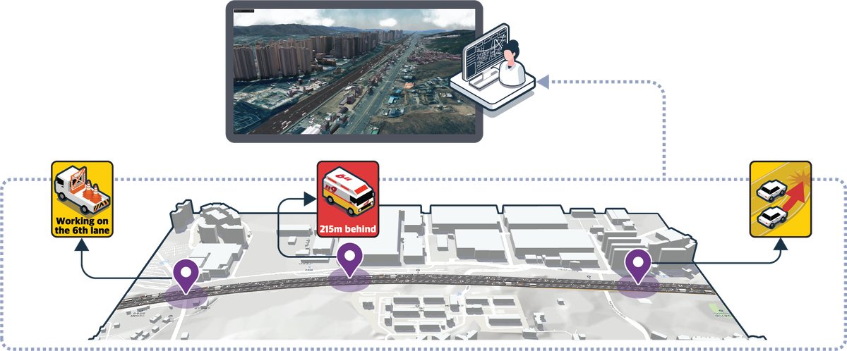
3D Digital Twin platform to visualize, analyze, and simulates traffic conditions.
A powerful 3D Digital Twin platform delivering an intuitive, user-friendly interface for instant situational awareness. Its immersive environment provides a realistic view with minimal data loss, integrating precise geospatial data, static HD-map layers, dynamic objects, and atmospheric conditions. The platform enables fleet monitoring, historical replay, simulation, and drone operations, empowering smarter, data-driven decision-making.
Read more
MapData
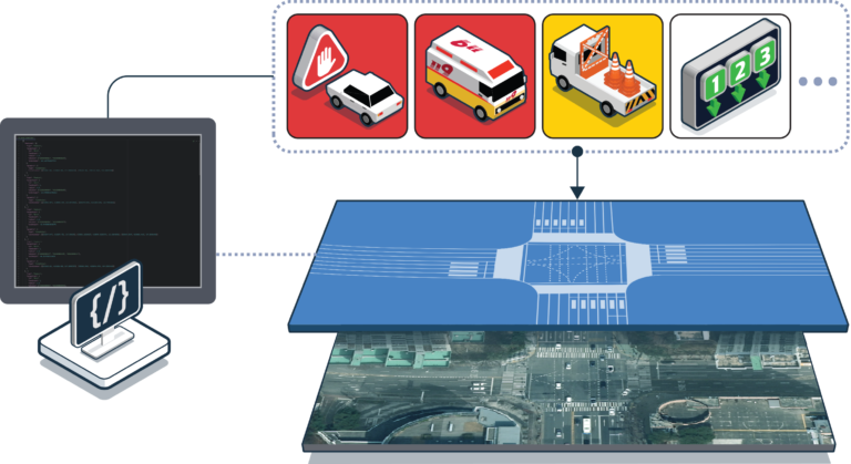
Automated MAPDATA Management System
A patented J2735 MAPDATA management system that generates real-time MapData messages from high-definition maps on demand. The platform automatically updates messages to reflect real-world road changes and supports upload, validation, and management of external data. It ensures accurate, up-to-date V2X information, enabling reliable, scalable, and efficient intelligent transportation operations.
Read more
SkyPather
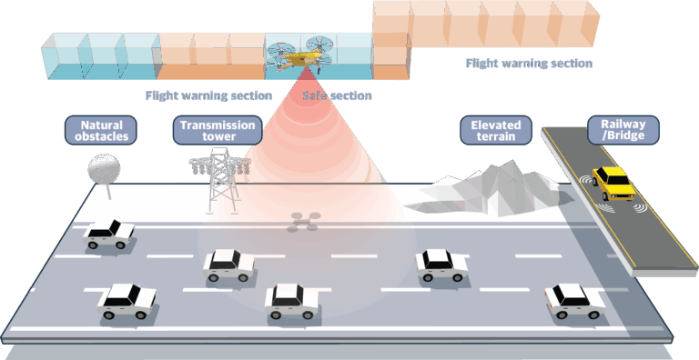
Autonomous Drone Path System Management System
An autonomous Drone Path Management System that automatically generates and deploys optimized flight paths on demand. Integrated with a 3D Digital Twin, it enables real-time drone monitoring, path simulation for safety validation, and instant deviation alerts. Ideal for traffic monitoring and infrastructure inspection, it ensures reliable, efficient, and intelligent aerial operations.
Read more