Products
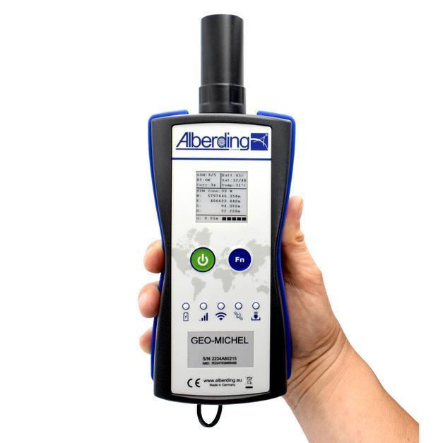
Alberding A08-RTK GEO-MICHEL®
The A08-RTK GEO-MICHEL® is a user-friendly RTK system for centimeter-accurate surveying and stakeouts.
The A08-RTK GEO-MICHEL® is a user-friendly RTK system for centimeter-accurate surveying and stakeouts. With a single button press, it connects to the RTK service and wirelessly transmits the position. The flexible mounting allows quick switching between handheld and pole setups. GEO-MICHEL® can be used with Alberding AGIS software or other apps. Stakeout coordinates can be sent directly to the device via Alberding ALPOS® Service.
Read more
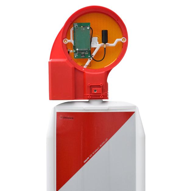
Alberding A08-Bake Sensor
The A08-Bake Sensor is a solution for the digital detection of construction site beacons.
The A08-Bake Sensor is a solution for the digital detection of construction site beacons. Certified for GeoTopLED and BakoLight LED, it delivers accurate positions, setup time, battery voltage, and tilt. Data is visualized via SmartTrack and transmitted to construction site information systems via MQTT.
Read more
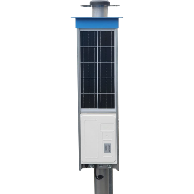
Alberding A08-MONiPOL
The Alberding A08-MONiPOL is a compact GNSS monitoring sensor with integrated sensor box and solar module.
The Alberding A08-MONiPOL is a compact GNSS monitoring sensor with integrated sensor box and solar module. It combines low cost, easy installation, robust design, and vandalism protection. The sensor automatically transmits measurement data via 4G-LTE to the server, where Alberding Monitoring Software (AMoS) processes the GNSS raw data.
Read more
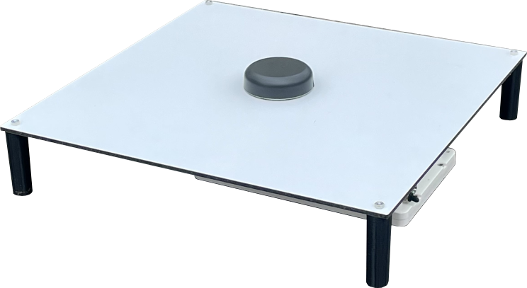
Alberding A08-Buoy

The A08-Buoy is a self-sufficient measuring system for determining the water level at navigation buoys.
The A08-Buoy is a self-sufficient measuring system for determining the water level at navigation buoys. A GNSS-RTK sensor integrated into the buoy top, powered by solar energy, provides highly precise data that can be visualized and analyzed via a web service. This enables the derivation of depth information and bridge clearance heights with an accuracy of ± 5 cm.
Read more
Alberding Digital Ground Control Point
A08 – Digital ground control point that calibrates itself.
With the 'digital ground control point', Alberding GmbH has introduced a process whereby the control point essentially measures itself. Target markers equipped with the A08 sensor are placed, secured and activated to record GNSS measurements.
While this is happening, the Alberding Smarttrack software logs the measurement data from virtual GNSS reference stations. The coordinates are calculated automatically, providing centimetre-precise positions digitally immediately after measurement.
Read more