
3D Target S.r.l.
STAND NUMBER:
03.213
CATEGORIES:
Product group
Road infrastructure:
Public lighting, Road construction & maintenance, Road marking/removal, Street furniture , Tunnel technology
Road safety:
Traffic signalling & control, Barriers, blocks & bumps
EVENT:
Intertraffic Amsterdam 2026
ADDRESS:
Via Preferita Traversa 1, 21 25014 CASTENEDOLO Brescia Italy
WEBSITE:
Products
View all products
Scanfly DUO
Start digitalize your roads today with Scanfly DUO
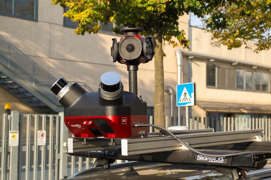
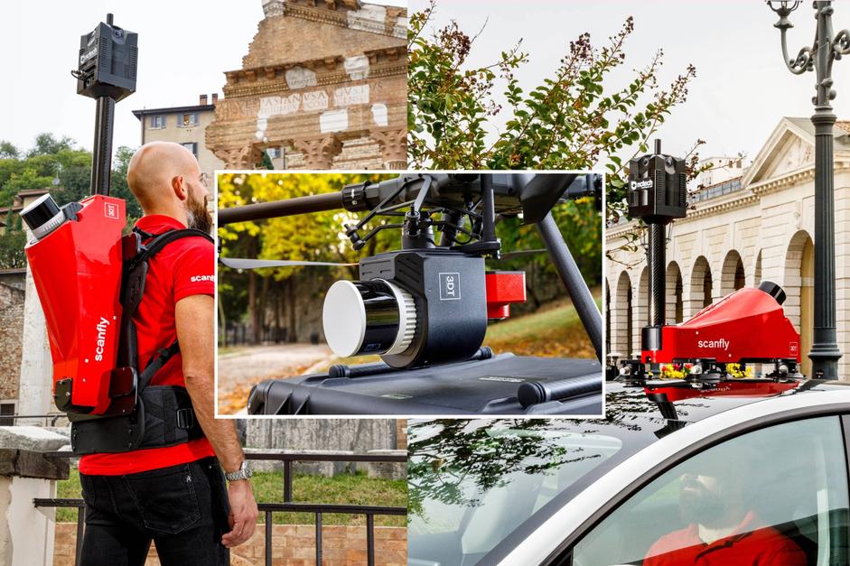
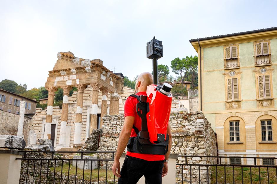
Scanfly DUO THE BRAND NEW, EASY-TO-USE TECHNOLOGY TO CAPTURE REALITY! Designed to be operated in the field by a single operator, Scanfly DUO is the ideal tool for digitizing metropolitan areas and infrastructure assets. With the help of the SLAM algorithm and the twin multi-channel Lidar heads, the environment can be precisely modelled with reduced shadows and increased accuracy in GNSS-diminished areas.Read moreScanfly PRO
THE MULTI-PLATFORM MAPPER Redefine mapping: anytime, anywhere with Scanfly PRO!
Scanfly PRO THE MULTI-PLATFORM MAPPER Introducing the Scanfly PRO, the 3DT‘s compact high-performance mapper. Engineered for excellence, this multi-platform LiDAR solution performs with no compromises even in the most challenging GNSS conditions, from tunnels to dense urban canyons. When unprecedented accuracy meets the unmatched versatility. Redefine mapping: anytime, anywhere with Scanfly PRO!Read moreScanfly EVO
The brand new, easy-to-use technology to capture reality! Powered by Hesai PandarXT-32
Scanfly EVO THE MULTI-PLATFORM MAPPER Unveiling the Scanfly EVO, the 3DT‘s entry level LiDAR mobile mapping solution. Building on a legacy that began in 2016, the EVO stands as the definitive multi-platform tool. Whether walking, driving, or flying, enjoy a seamless, tool-less, and cable-free experience. Ensure unparalleled value with every survey. Experience the EVOlution – Map effortlessly with Scanfly EVO!Read moreSmartProcessing Lidar

Your point clouds, at their best!
A keystone of the easy-to-use philosophy of Scanfly, SmartProcessing Lidar features the 3D Target’s proprietary direct geo-referencing engine to empower the extraction of accurate point clouds from the best estimate of the trajectory and the synchronized Lidar data.Read moreSmartSurvey
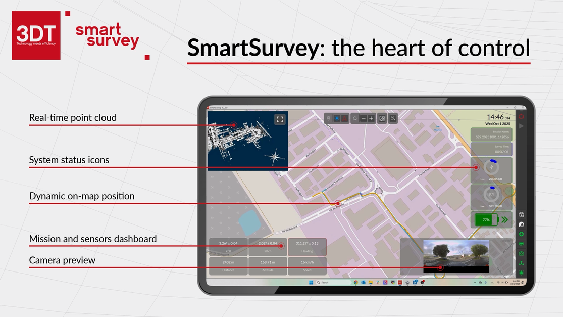
SmartSurvey is the desktop software to configure and control the data acquisition of Scanfly sensors in real-time
The Mission planning is simplified by importing KML files for the route and quickly configuring pre-acquisition parameters, data quality is ensured by the inspection of the Point Cloud in real-time and the verification of camera synchronization via full-screen preview. SmartSurvey: the heart of controlRead moreSmartProcessing
Dedicated AI tools, enable to extract the significant features and information in the fully configurable tables of a geospatial database.
SmartProcessing is the most advanced mobile mapping data analysis tool in the market today. Developed from 3D Target’s experiences in road asset management projects, the software has evolved to accept inputs from multiple sensors and handle large datasets.Read more